
Rand McNally Folded Map: Philadelphia & Southeast Pennsylvania Regional Map
Rand McNally
ISBN13:
9780528025594
$10.78
(No reviews yet)

Write a Review
Rand McNally
Rand McNally Folded Map: Philadelphia & Southeast Pennsylvania Regional Map
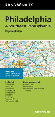
Rand McNally's folded map for Philadelphia & Southeast Pennsylvania is a must-have for anyone traveling in and around this part of Ohio, offering unbeatable accuracy and reliability at a great price. Our trusted cartography shows all Interstate, U.S., state, and county highways, along with clearly indicated parks, points of interest, airports, county boundaries, and streets. The easy-to-use legend and detailed index make for quick and easy location of destinations. You'll see why Rand McNally folded maps have been the trusted standard for years. - Regularly updated. - Full-color maps. - Clearly labeled Interstate, U.S., state, and county highways. - Indications of parks, points of interest, airports, county boundaries, downtown & vicinity maps. - Major attractions & Golf Courses. - Enlargements of Atlantic City, Philadelphia, Philadelphia International Airport. - Easy-to-use legend. - Detailed index & Major Street Index. - Convenient folded size. Coverage Area: Allentown, Berlin NJ, Bethlehem, Camden NJ, Doylestown, Lancaster, Reading, Trenton NJ, Wilmington, DE.
- | Author: Rand Mcnally, Rand Mcnally
- | Publisher: Rand Mcnally
- | Publication Date: Aug 08, 2023
- | Number of Pages: NA pages
- | Language: English
- | Binding: Map
- | ISBN-10: 0528025597
- | ISBN-13: 9780528025594
- Author:
- Rand Mcnally, Rand Mcnally
- Publisher:
- Rand Mcnally
- Publication Date:
- Aug 08, 2023
- Number of pages:
- NA pages
- Language:
- English
- Binding:
- Map
- ISBN-10:
- 0528025597
- ISBN-13:
- 9780528025594